Water Management Protects Our Environment
Effective management of agricultural irrigation runoff and stormwater discharge is essential to protect local water quality and meet regulatory requirements.
About the Water Quality Management Plan (WQMP)
VCAILG prepares and submits Water Quality Management Plans to the Los Angeles Regional Water Quality Control Board (Regional Board) as required by the Ag Order. Updated approximately every three years, these plans outline the strategies, actions, and requirements needed to help growers meet local water quality standards and protect our shared natural resources.
- Latest approved WQMP: 2020 Water Quality Management Plan (PDF)
- Each Each Responsibility Area has its own section with:
- Membership and crop data
- BMPs survey results
- Water quality exceedances
- Required BMP implementation actions
How the WQMP Works
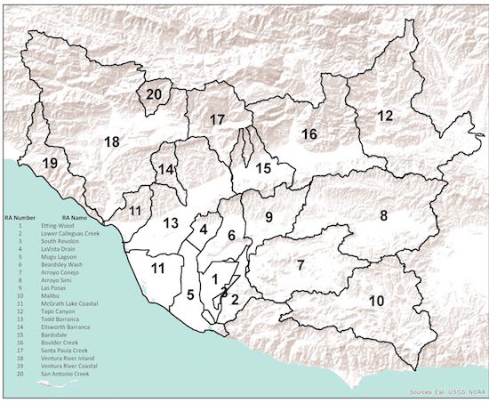
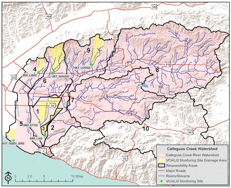
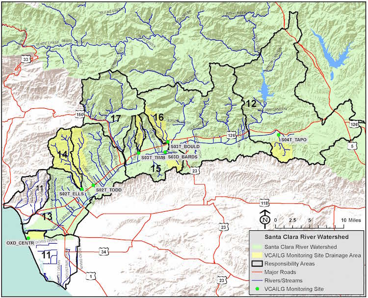
- Responsibility Areas: Ventura County is divided into 31 Responsibility Areas based primarily on Total Maximum Daily Load (TMDL) requirements, while also accounting for subwatersheds, drainage patterns, and crop similarities.
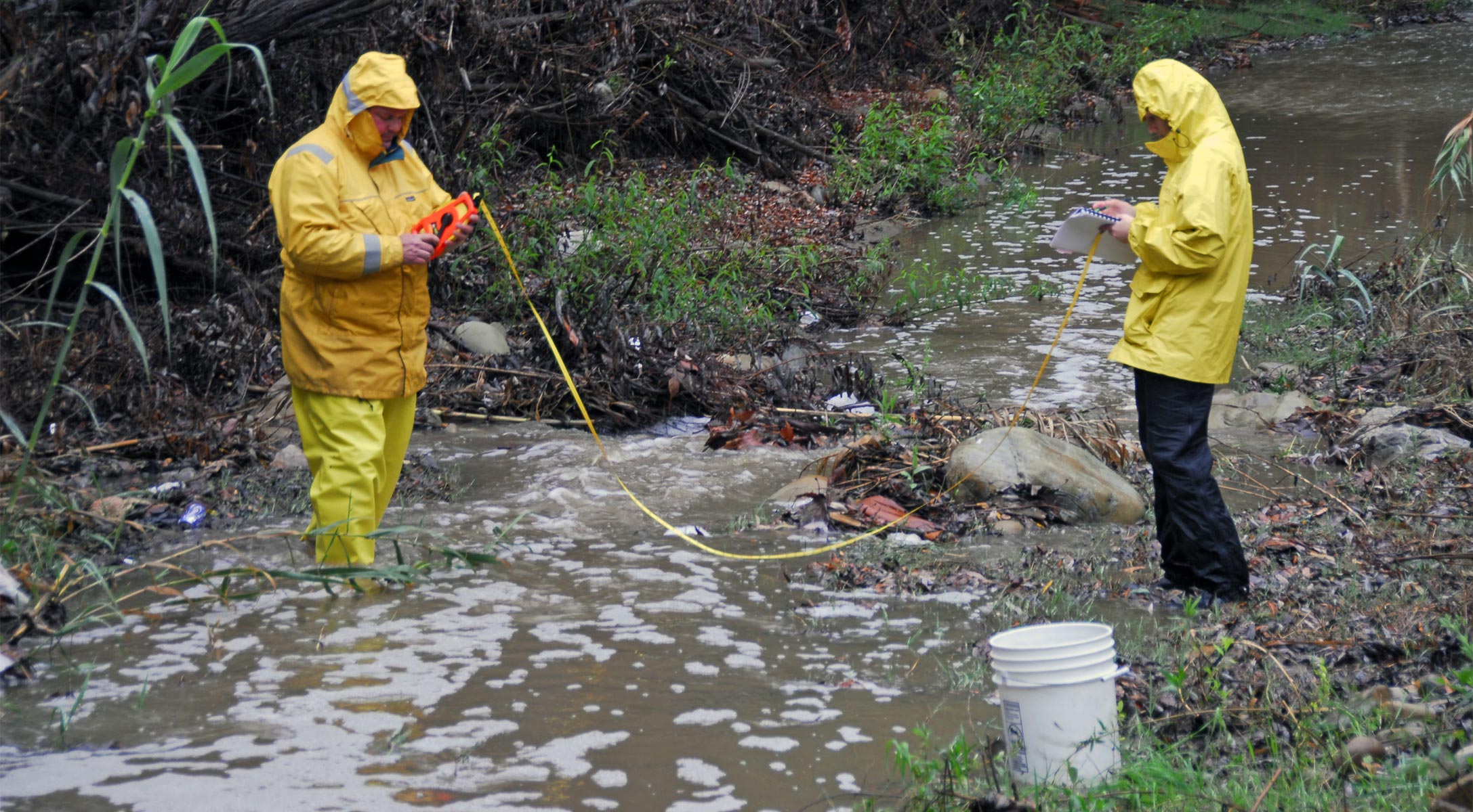
- Representative Monitoring Sites: Each Responsibility Area has one assigned water quality monitoring site that is considered representative of the larger RA.
- Enrollee Accountability: If monitoring shows water quality issues, landowner and grower enrollees in that Responsibility Area must implement targeted Management Practices (MPs).
Finding Your Responsibility Area & Requirements
To help our members, VCAILG has created a compliance summary handout for each Responsibility Area that contains all the specific information members need to know to meet waiver requirements. Each compliance summary includes:
- Responsibility Area identification
- Beacon Site and continuing water quality issues identification
- BMPs Survey participation notice
- Required Documentation to be kept on site
- Education requirement notice
- Resources information for BMPs assistance if specific funding is available in your area
- Required BMPs table (and online resource links)
- Responsibility Area by Parcel List
To get started, identify your parcel’s watershed on the maps in the following sections or search the Responsibility Area listing below. (Any parcel located on a border has been assigned to only one Responsibility Area.) Please email us at [email protected] if your parcel is not listed or does not indicate a Responsibility Area.
Print Your Compliance Summary
The next step is to download and print the compliance summary for your Responsibility Area (links below) or contact us and we can email it to you. Please note that each compliance summary includes online links to technical information about how to implement many of the BMPs and why these actions are important to protect water quality.
Calleguas Creek Watershed Responsibility Areas Compliance Summaries
1 Etting-Wood 04D_ETTG (267 KB)
2 LowerCalleguas Creek-04D_ETTG (268 KB)
3 SouthRevolon-04D_LAS (266 KB)
4 LaVistaDrain-05D_LAVD (263 KB)
5 Mugu Lagoon OIT_ODD3_ARN (264 KB)
5 Mugu Lagoon-OIT_ODD3_ARN(oxnard drain #3TMDL area) (265 KB)
6 Beardsley Wash 05T_HONDO (263 KB)
7 Arroyo Conejo 06T_LONG2 (244 KB)
8 ArroyoSimi-06T_LONG2 (244 KB)
9 LasPosas-06T_LONG2 (244 KB)
10 Malibu-05T_HONDO (249 KB) (Proxy monitoring site for Malibu)
Santa Clara River and Oxnard Coastal Watersheds Responsibility Areas Compliance Summaries
11 McGrath Lake Coastal OXD_CENTR (264 KB)
12 Tapo Canyon S04_TAPO (263 KB)
13 Todd Barranca S02T_TODD (263 KB)
14 Ellsworth Barranca SO2T_ELLS (248 KB)
15 Bardsdale S03D_BARDS (243 KB)
16 Boulder Creek S03T_BOULD (243 KB)
17 Santa Paula Creek S03T_TIMB (238 KB)
Ventura River Watershed Responsibility Areas Compliance Summaries
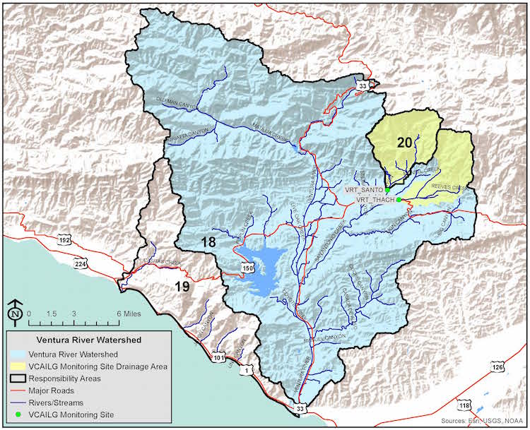
18 Ventura River Inland VRT_THACH (246 KB)
19 Ventura River Coastal – VRT_THACH (238 KB)
20 San Antonio Creek-VRT_SANTO (246 KB)
2020 Water Quality Management Plan
All VCAILG members should read (see link below) the most current Water Quality Management Plan. Each Responsibility Area has its own section in the 2020 Water Quality Management which details membership and crop data, BMPs survey results, water quality monitoring exceedances and required BMPs implementation.